New England – Another snowstorm is in the forecast for mid-week.
A messy system will be moving through the area Wednesday into Thursday morning. We still have about 48 hours until the storm starts to move into the area. I am expecting a mix of rain and snow to be more prominent in Southern areas of the state, while heavier snowfall will take place in the North Country, White mountains, and parts of the Lakes Region.
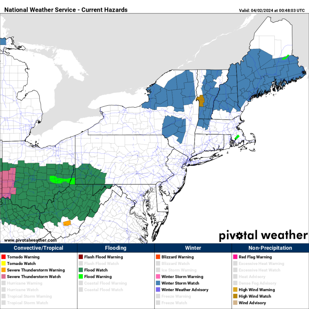
Winter Storm Watches have been posted for all counties excluding Cheshire, Hillsborough, and Rockingham.
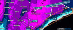
Expected snowfall, as of Monday Night at 8:54 PM will again be heavier the farther north you get. Southern areas are still questionable for totals, depending on how long the mixing takes place.
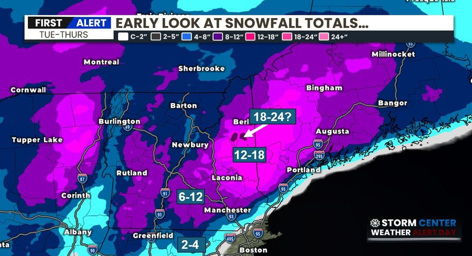
Here’s a look at the HRR Future cast model for early Wednesday afternoon showing snowfall moving its way north, and heavy rainfall for areas where temperatures will be above freezing. Concern for power outages is high as well with this storm. Winds will be gusting over 45 MPH at times in localized areas which could bring limbs down.

I will have more information tomorrow, so you can follow me on social media for the most up – to date forecast.
Have a great day and stay safe!
–James